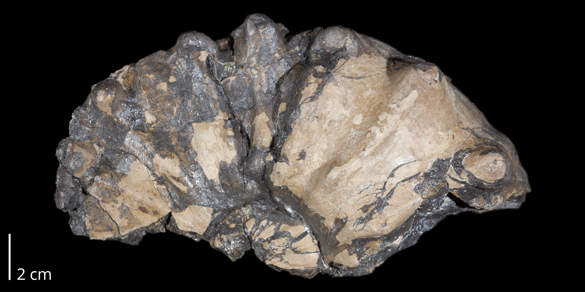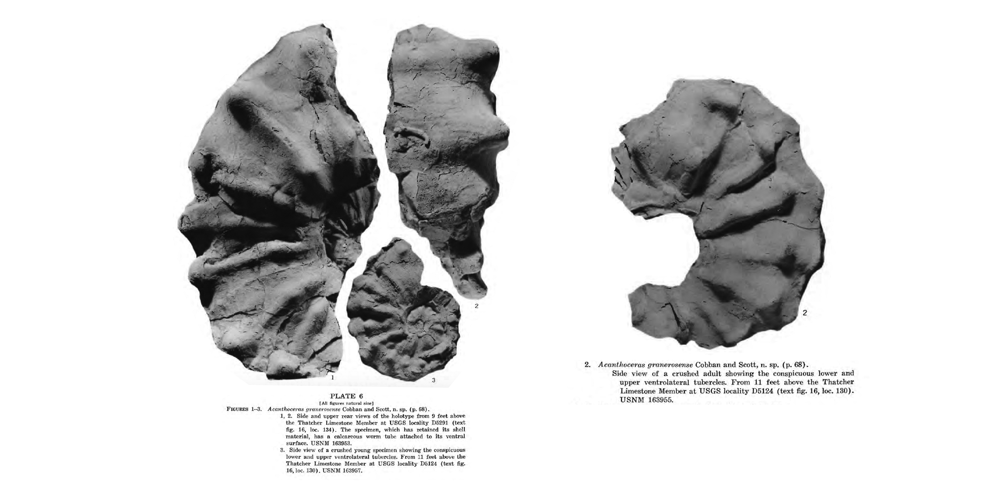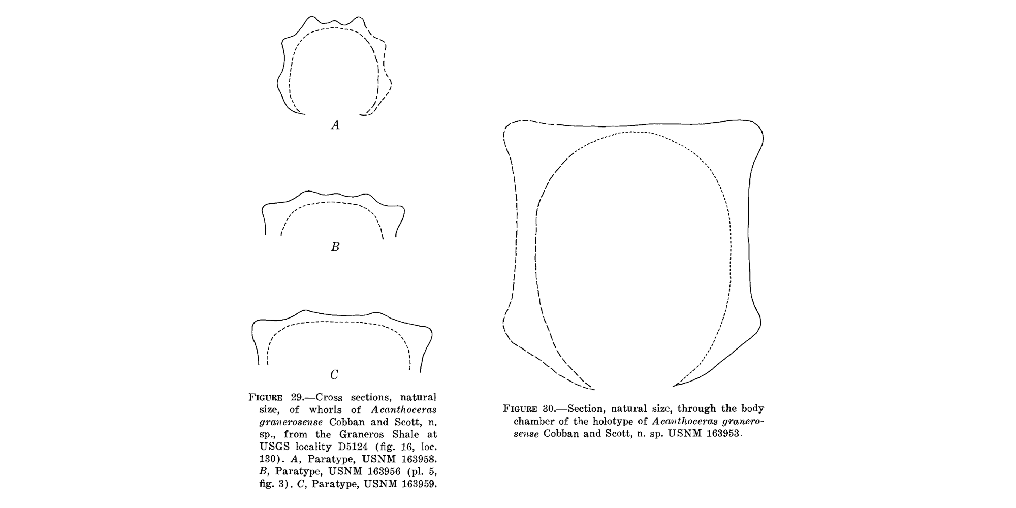
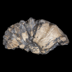
Acanthoceras granerosense
- Phylum: Mollusca
- Class: Cephalopoda
- Order: Ammonoidea
- Family: Acanthoceratidae
- Genus: Acanthoceras
- Species: Acanthoceras granerosense Cobban and Scott, 1973
Geological Range
AWAITING DETERMINATION.
Acanthoceras granerosense Zone: Middle Cenomanian 95.73 ± 0.61 to 94.96 ± 0.50
Paleogeographic Distribution
Southeastern Colorado (Cobban and Scott, 1973).
Remarks
Original presentation: Acanthoceras granerosense
Original publication: Cobban and Scott. 1973. Stratigraphy and ammonite fauna of the Graneros Shale and Greenhorn Limestone near Pueblo, Colorado. USGS Professional Paper 645. [p. 68-70, pl. 2, figs 1-4, pl. 4, fig. 2, pl. 5, fig. 3, pl. 6, figs. 1-3, text figs 29, 30].
Holotype: USNM 163953. Access Smithsonian NMNH specimen record here.
Type locality: USGS locality D5291, Pueblo County, Colorado.
Type horizon: Graneros Shale, “9 feet above the Thatcher Limestone Member” (Cobban and Scott, 1973, pl. 6, figs 1, 2 caption).
Zonation: Acanthoceras granerosense zone = Middle Cenomanian (94.96 +/- 0.50 Ma) (Cobban et al., 2006).
Synonyms: none known.
References: Cobban and Scott (1973).
Stratigraphic Occurrences
- Cenomanian
- Graneros Shale (CO)